Distance: 0.5 miles
Elevation: 8,557 ft - 8,640 ft
Elevation Gain: 83 ft
The Alluvial Fan is a short but scenic trail in Rocky Mountain National Park suitable for elders and children. The trail crosses an area of waterfalls, boulders, and Aspens that formed when the Lawn Lake Dam broke upstream on July 15, 1982. Shortly after 5:30 AM, water and debris tumbled down the Roaring River Valley. People camping along the river reported that the water rose 22-30 ft. One camper in this area was killed.
As the water exited the narrow river valley and spread out into Horseshoe Park, it overran a campground and killed a few more people. Logs, house-sized boulders, and sand was dumped into a large pile.
The water then traveled toward the town of Estes Park, the gateway community to Rocky Mountain National Park. It took out a small hydroelectric power plant and fish hatchery before sending a river of mud through the downtown area. Finally, the water flowed into the Big Thompson River and dumped into Lake Estes. Total cost of the accident was $31M.
Today, a walk across this debris field is both scenic and sobering. Tourists gather amongst the rocks, water either roars or trickles through the area depending upon the season, and trees have grown up along the edges. The route has minimal elevation gain and winds through the debris. It is 0.5 miles between the east and west Alluvial Fan parking lots and roughly 0.25 miles from either lot to the center of the fan. From the top of the mound there are also great views of the Endovalley/Horseshore Park area.
Tampilkan postingan dengan label Rocky Mountain National Park. Tampilkan semua postingan
Senin, 06 Desember 2010
Senin, 29 November 2010
Spague Lake Nature Loop
Distance: 0.9 mile loop
Elevation: 8,694 ft
Elevation Gain: None
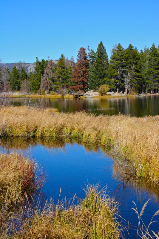
The trail around Sprague Lake in Rocky Mountain National Park near Estes Park is short, flat, and very scenic. I took my parents there on their recent Colorado vacation. We ate lunch on one of many picnic tables near the trailhead and then strolled the short route around the lake. The trail is well groomed, totally flat, and suitable for everyone. The views change constantly providing a great deal of variety in a short distance.
Sprague Lake has in interesting history as well. It is actually man made and was constructed by Abner Sprague who owned a lodge nearby long before the area became a National Park. You would never be able to tell this by the "naturalness" of the setting.
The lake is well stocked with fish and you can actually see them in the outlet stream and even larger specimens along the lake shore.
Looking southwest in early October on my first visit. Note the fisherman standing well out in the water
The first time I visited this lake, I only walked part way around, trying to judge if it would be suitable for the parental units. I did not notice at that time the stunning views of the Continental Divide including Hallett (12,713 ft), Taylor (13,153 ft), and Otis (12,486 ft) peaks that greet the visitor half way around. I wish ole Abner had sold his land to me so I could have that view for my living room window.
If you visit Rocky Mountain National Park, don't exclude Sprague Lake from your list, particularly if you are staying at the nearby Glacier Gorge Campground. There is a short 0.8 mile trail between the campground and the lake.
Elevation: 8,694 ft
Elevation Gain: None
The trail around Sprague Lake in Rocky Mountain National Park near Estes Park is short, flat, and very scenic. I took my parents there on their recent Colorado vacation. We ate lunch on one of many picnic tables near the trailhead and then strolled the short route around the lake. The trail is well groomed, totally flat, and suitable for everyone. The views change constantly providing a great deal of variety in a short distance.
Sprague Lake has in interesting history as well. It is actually man made and was constructed by Abner Sprague who owned a lodge nearby long before the area became a National Park. You would never be able to tell this by the "naturalness" of the setting.
The lake is well stocked with fish and you can actually see them in the outlet stream and even larger specimens along the lake shore.
Looking southwest in early October on my first visit. Note the fisherman standing well out in the waterIf you visit Rocky Mountain National Park, don't exclude Sprague Lake from your list, particularly if you are staying at the nearby Glacier Gorge Campground. There is a short 0.8 mile trail between the campground and the lake.
Senin, 22 November 2010
Loch Vale Hike
Distance: 6 miles round trip
Elevation: 8,787 ft - 10,220ft
Elevation Gain: 1,433 ft
Critters: Stellar's Jay
Loch Vale is a classic hike in Rocky Mountain National Park that many visitors do on their summer vacations. It is relatively easy, has interesting milestones along the way, and ends at a spectacular lake. It is suitable for beginning hikers.
I have snowshoed to Loch Vale many times but have not hiked it in the summer in a while and never as a destination in and of itself. Usually, it is just a milestone on the way to Sky Pond. On this trip, I had a friend visiting on a short Colorado vacation and this was a perfect trail for her.
The trail to Loch Vale begins at the Glacier Gorge Trailhead. At 0.9 miles is Alberta Falls, which rages in the spring and is frozen over in the winter. Tourists gather about the rocks snapping pictures of themselves. Be sure to stop here and look down into the gorge as well. This part of the trail is broad and well manicured. It winds through juvenile Aspens and conifers.
Above Alberta Falls, the trails switchbacks up the hillside until it enters Glacier Gorge, a wind tunnel filled with stunning rocks and "peak-a-boos". Along the way are large pull outs for landscape photography.
At 2.23 miles is the junction with Mills Lake and Lake Haiyaha. From this point, the trail heads up a series of switchbacks with views of the gorge (see winter route) . The switchbacks are not long or arduous. At the top is Loch Vale. There is a trail that circumnavigates the lake and lots of "beaches", rocks, and peninsulas to lounge on.
In the winter, this spot is one of the coldest in Colorado, but on this trip in early October it was balmy. My friend and I sat by the lake and ate lunch. An aggressive Stellar's Jay kept us company and ogled our sandwiches.
If you are visiting Rocky Mountain National Park, add this trail to your list. It won't disappoint. Add one mile to your trip and visit Mills Lake on the way back. From the LochVale/Mills trail junction it is a short 0.5 miles and minimal elevation gain to Mills.
Wind blown Bristlecone Pines on a peninsula jutting out into the lake
Elevation: 8,787 ft - 10,220ft
Elevation Gain: 1,433 ft
Critters: Stellar's Jay
Loch Vale is a classic hike in Rocky Mountain National Park that many visitors do on their summer vacations. It is relatively easy, has interesting milestones along the way, and ends at a spectacular lake. It is suitable for beginning hikers.
I have snowshoed to Loch Vale many times but have not hiked it in the summer in a while and never as a destination in and of itself. Usually, it is just a milestone on the way to Sky Pond. On this trip, I had a friend visiting on a short Colorado vacation and this was a perfect trail for her.
The trail to Loch Vale begins at the Glacier Gorge Trailhead. At 0.9 miles is Alberta Falls, which rages in the spring and is frozen over in the winter. Tourists gather about the rocks snapping pictures of themselves. Be sure to stop here and look down into the gorge as well. This part of the trail is broad and well manicured. It winds through juvenile Aspens and conifers.
Above Alberta Falls, the trails switchbacks up the hillside until it enters Glacier Gorge, a wind tunnel filled with stunning rocks and "peak-a-boos". Along the way are large pull outs for landscape photography.
At 2.23 miles is the junction with Mills Lake and Lake Haiyaha. From this point, the trail heads up a series of switchbacks with views of the gorge (see winter route) . The switchbacks are not long or arduous. At the top is Loch Vale. There is a trail that circumnavigates the lake and lots of "beaches", rocks, and peninsulas to lounge on.
In the winter, this spot is one of the coldest in Colorado, but on this trip in early October it was balmy. My friend and I sat by the lake and ate lunch. An aggressive Stellar's Jay kept us company and ogled our sandwiches.
If you are visiting Rocky Mountain National Park, add this trail to your list. It won't disappoint. Add one mile to your trip and visit Mills Lake on the way back. From the LochVale/Mills trail junction it is a short 0.5 miles and minimal elevation gain to Mills.
Wind blown Bristlecone Pines on a peninsula jutting out into the lakeSabtu, 18 September 2010
Lake Haiyaha to Bear Lake Shuttle
Distance: 3.6 miles to Lake Haiyaha (one-way), 7.2 miles (out and back), 5.7 miles (to Bear Lake Shuttle).
Elevation: 9,200 ft (Glacier Gorge Trailhead), 10,286 ft (Max Elevation on trail between Lake Haiyaha and Dream Lake), 9,475 ft (Bear Lake)
Elevation Gain: 1,556 ft
Lake Haiyaha means "place of big rocks with not as many tourists as Dream Lake" in indigenous Arapaho. This less frequently visited destination within Rocky Mountain National Park is indeed surrounded by huge boulders that have tumbled down from Chaos Canyon. The lake, which is located in a draw between Hallet and Otis peaks, is a deep emerald color.
You can visit the lake four ways, as an out and back from either the Glacier Gorge or Bear Lake trailheads or as shuttle from either location. I have done this hike twice now and both times I started at Glacier Gorge and ended at Bear Lake. The convenient Park Shuttle dropped me off and picked me up from both trailheads.
Summer in Rocky Mountain National Park is a precursor to Elk bugling season...be one with the herd. In this instance, however, I was with a large group that took up a quarter of the shuttle bus. Herd indeed.
The signs at the Mills Lake...Loch Vale trail junction
We started at the Glacier Gorge trailhead and quickly arrived at Alberta Falls at 0.87 miles. The route from Alberta Falls to the Mills Lake/Loch Vale trail junction (at 2.17 miles) is one of my favorites. The route switchbacks steadily upwards on a well groomed trail. There are plenty of vista points and the ever pleasant journey through Glacier Gorge itself. This segment is a rock shelf overlooking a precipitous gorge surrounded by towering rock walls. Don't worry about exposure here though, this shelf is wide and welcoming.
From the Loch side of this junction is the sign for Lake Haiyaha. The turn off is within spitting distance (we did test this out) of the junction, so you don't have to worry about missing it. Another sign warns that the trail to the lake is unimproved. This is unimproved by National Park standards, which means it is still quite cushy by Colorado standards.
This segment of the route is more in the trees and climbs more intensively. At 2.64 miles is a small lake on the right. It has nice views, so take a break and walk out to it. At 3.34 miles is a turn off to the lake. This too is marked by an obvious sign. 0.3 miles further up the trail you come to the large rocks surrounding the lake.
Our group enjoyed lunch spralled out on the rocks. These boulders are quite large and angular. It made it difficult to navigate and certainly time consuming to get down to the water. I chose to sunbath and take pictures.
From this point, the hiker can turn around and head back to Glacier Gorge or continue on to Dream Lake (9,912 ft) at 4.57 miles. This route takes the hiker upwards to a maximum elevation of 10,286 ft. before heading downwards on a narrow shelf towards Dream Lake. In spring, this route can be treacherous indeed, but once the snows have melted it is easy going with spectacular views of Longs Peak.
Dream Lake is a short 2/10ths of a mile off the route, and since this is one of the most visited locations in the park, a mandatory detour. Take a moment to admire the twisted trees around the lake before heading down to restful Nymph Lake at 5 miles (9,705 ft). From Nymph Lake it is only 0.7 miles to the Bear Lake and the shuttle bus.
Despite the crowds, hiking in Rocky Mountain National Park is always pleasant. There is something about a National Park and its manicured wilderness that is cozy and comforting. I was surprised by the number of dead Lodgepole Pines, however. The Pine Bark Beetle is firmly entrenched on the eastern slope.
Elevation: 9,200 ft (Glacier Gorge Trailhead), 10,286 ft (Max Elevation on trail between Lake Haiyaha and Dream Lake), 9,475 ft (Bear Lake)
Elevation Gain: 1,556 ft
Lake Haiyaha means "place of big rocks with not as many tourists as Dream Lake" in indigenous Arapaho. This less frequently visited destination within Rocky Mountain National Park is indeed surrounded by huge boulders that have tumbled down from Chaos Canyon. The lake, which is located in a draw between Hallet and Otis peaks, is a deep emerald color.
You can visit the lake four ways, as an out and back from either the Glacier Gorge or Bear Lake trailheads or as shuttle from either location. I have done this hike twice now and both times I started at Glacier Gorge and ended at Bear Lake. The convenient Park Shuttle dropped me off and picked me up from both trailheads.
Summer in Rocky Mountain National Park is a precursor to Elk bugling season...be one with the herd. In this instance, however, I was with a large group that took up a quarter of the shuttle bus. Herd indeed.
The signs at the Mills Lake...Loch Vale trail junctionFrom the Loch side of this junction is the sign for Lake Haiyaha. The turn off is within spitting distance (we did test this out) of the junction, so you don't have to worry about missing it. Another sign warns that the trail to the lake is unimproved. This is unimproved by National Park standards, which means it is still quite cushy by Colorado standards.
This segment of the route is more in the trees and climbs more intensively. At 2.64 miles is a small lake on the right. It has nice views, so take a break and walk out to it. At 3.34 miles is a turn off to the lake. This too is marked by an obvious sign. 0.3 miles further up the trail you come to the large rocks surrounding the lake.
Our group enjoyed lunch spralled out on the rocks. These boulders are quite large and angular. It made it difficult to navigate and certainly time consuming to get down to the water. I chose to sunbath and take pictures.
From this point, the hiker can turn around and head back to Glacier Gorge or continue on to Dream Lake (9,912 ft) at 4.57 miles. This route takes the hiker upwards to a maximum elevation of 10,286 ft. before heading downwards on a narrow shelf towards Dream Lake. In spring, this route can be treacherous indeed, but once the snows have melted it is easy going with spectacular views of Longs Peak.
Dream Lake is a short 2/10ths of a mile off the route, and since this is one of the most visited locations in the park, a mandatory detour. Take a moment to admire the twisted trees around the lake before heading down to restful Nymph Lake at 5 miles (9,705 ft). From Nymph Lake it is only 0.7 miles to the Bear Lake and the shuttle bus.
Despite the crowds, hiking in Rocky Mountain National Park is always pleasant. There is something about a National Park and its manicured wilderness that is cozy and comforting. I was surprised by the number of dead Lodgepole Pines, however. The Pine Bark Beetle is firmly entrenched on the eastern slope.
Sabtu, 10 Oktober 2009
Dream Lake
Distance: 2.2 miles round trip
Elevation:9,470 ft - 9,900 ft
Elevation Gain: 430 ft
Dream Lake on a less than stellar day. What you don't see in this picture is the 20 or so people standing about taking pictures. Most looked very uncomfortable in the deteriorating weather conditions.
On 20 September, I took our Turkish graduate student Ufuk and his wife Malda on a short hike in Rocky Mountain National Park. Our actual destination was Emerald Lake, which lies 0.6 miles beyond Dream Lake, but an unforecasted series of storms turned us around at Dream Lake. They did not have rain gear and the temperature was in the 50s. A perfect recipe for hypothermia.

In recent years, I have only snowshoed this route because it is so short and is often mobbed with tourists. It is absolutely lovely, however, and I may make it an annual outing for the Sierra Club in the fall when the Elk are bugling and the Aspens are turning.
The trail to Dream lake is meant to be handicapped accessible, but the pavement is so eroded, I would hesitate to take anything with wheels on it. The trail starts to climb a series of steps after Nymph Lake (0.5 miles), so from that point on it is able bodies only.
I love taking pictures of the Krummholz trees at Dream Lake. They are so twisted, no pun intended...well maybe.
I don't know what it is about Rocky Mountain National Park, but it always seems to be windy there and this trip was no exception. As soon as we crested the lip of the lake, our jackets and pant legs puffed up. This is not true for other areas in Colorado, so don't judge the state by this area alone.
Waves of rain hitting Longs Peak. This was not a good day to climb the mountain. It does not look bad in this shot. Most of the day, you could not see the summit at all.
While this trail is short, there are so many lookouts with stupendous views that it takes much longer than one would think. For anyone visiting the park for the first time, you need to do this trail at least once. It can be a warm up for longer adventures or the climax of a less strenuous trip. Just be prepared for wind, weather, and whacked out tourists jumping up and down with each new view.
Elevation:9,470 ft - 9,900 ft
Elevation Gain: 430 ft
Dream Lake on a less than stellar day. What you don't see in this picture is the 20 or so people standing about taking pictures. Most looked very uncomfortable in the deteriorating weather conditions.On 20 September, I took our Turkish graduate student Ufuk and his wife Malda on a short hike in Rocky Mountain National Park. Our actual destination was Emerald Lake, which lies 0.6 miles beyond Dream Lake, but an unforecasted series of storms turned us around at Dream Lake. They did not have rain gear and the temperature was in the 50s. A perfect recipe for hypothermia.

In recent years, I have only snowshoed this route because it is so short and is often mobbed with tourists. It is absolutely lovely, however, and I may make it an annual outing for the Sierra Club in the fall when the Elk are bugling and the Aspens are turning.
The trail to Dream lake is meant to be handicapped accessible, but the pavement is so eroded, I would hesitate to take anything with wheels on it. The trail starts to climb a series of steps after Nymph Lake (0.5 miles), so from that point on it is able bodies only.
I love taking pictures of the Krummholz trees at Dream Lake. They are so twisted, no pun intended...well maybe.I don't know what it is about Rocky Mountain National Park, but it always seems to be windy there and this trip was no exception. As soon as we crested the lip of the lake, our jackets and pant legs puffed up. This is not true for other areas in Colorado, so don't judge the state by this area alone.
Waves of rain hitting Longs Peak. This was not a good day to climb the mountain. It does not look bad in this shot. Most of the day, you could not see the summit at all.While this trail is short, there are so many lookouts with stupendous views that it takes much longer than one would think. For anyone visiting the park for the first time, you need to do this trail at least once. It can be a warm up for longer adventures or the climax of a less strenuous trip. Just be prepared for wind, weather, and whacked out tourists jumping up and down with each new view.
Langganan:
Postingan (Atom)
Diberdayakan oleh Blogger.