Distance: 3 miles round trip
Elevation: 10,900 ft -11,200 ft
Elevation gain: 300 ft
On our last day in Leadville, we wanted a simple trail that we could explore in a couple of hours because we had to head back down to Denver and we were tired after our trip to Vance's Cabin the day before. Our host at the Leadville Hostel, told us to just head straight up CO Rd 3, pass under the bridge for the Mineral Belt trail, and park when the road ended. From there he said you could go in numerous directions. We decided to continue up Co Rd 3, which is lower Mosquito Pass Road.
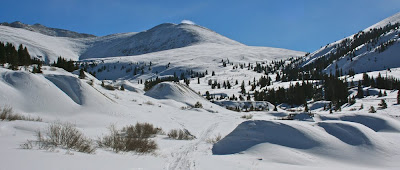
This route has fantastic views of the Continental Divide, mining ruins, and snowy hillsides so warm and fluffy we wanted to reach out and pet them. Add to this a “chamber of commerce” blue sky and you will understand why we love the mountains. There were two Brits staying with us at the Hostel who, despite their phenomenal exchange rate, had spent significantly more than we did to enjoy this Colorado experience.
In short order the road circumnavigated a vast meadow filled with snow-covered mining ruins. From a distance these looked like dollhouses in a Santa Clause village. The mine tailings, undoubtedly guaranteed to ensure your sterility, were similarly transformed into fluffy hillocks behind which naughty elves plotted snowball ambushes.
At some point, we ended up veering off of Co Rd 3 onto an unnamed road heading west. There was so much snow in the area, and we were following a snowmobile track that it was not until later that I realized we were no longer on Mosquito Pass Road.
Eventually, time ran out on us but I have been told this western heading road continues for some distance with periodic views of the Collegiate Peaks. You won’t find this trip in any guidebook, but it is well worth doing on a clear day.
Someday I shall return and head further up Mosquito Pass Road. The views of Mount Massive to the west must be phenomenal.
Langganan:
Posting Komentar (Atom)
Diberdayakan oleh Blogger.


Tidak ada komentar:
Posting Komentar