Kamis, 24 Januari 2008

Lower Mosquito Pass Road Snowshoe

Distance: 3 miles round trip
Elevation: 10,900 ft -11,200 ft
Elevation gain: 300 ft

Looking east towards the Mosquito Range from our unnamed road.

On our last day in Leadville, we wanted a simple trail that we could explore in a couple of hours because we had to head back down to Denver and we were tired after our trip to Vance's Cabin the day before. Our host at the Leadville Hostel, told us to just head straight up CO Rd 3, pass under the bridge for the Mineral Belt trail, and park when the road ended. From there he said you could go in numerous directions. We decided to continue up Co Rd 3, which is lower Mosquito Pass Road.

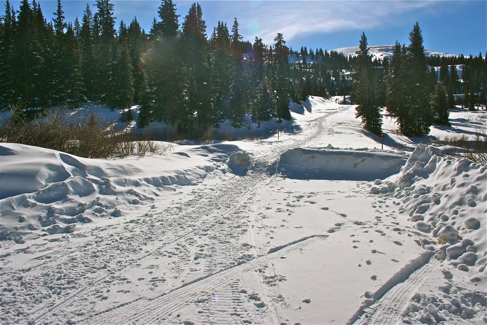
The parking area where the road is no longer plowed

Co Rd 3 makes a sharp right turn and cross a drainage.

This route has fantastic views of the Continental Divide, mining ruins, and snowy hillsides so warm and fluffy we wanted to reach out and pet them. Add to this a “chamber of commerce” blue sky and you will understand why we love the mountains. There were two Brits staying with us at the Hostel who, despite their phenomenal exchange rate, had spent significantly more than we did to enjoy this Colorado experience.

Looking back down the drainage to the west

A little farther up the road

In short order the road circumnavigated a vast meadow filled with snow-covered mining ruins. From a distance these looked like dollhouses in a Santa Clause village. The mine tailings, undoubtedly guaranteed to ensure your sterility, were similarly transformed into fluffy hillocks behind which naughty elves plotted snowball ambushes.

All of the mounds are mine tailings

Is that Mt. Evans directly ahead?

At some point, we ended up veering off of Co Rd 3 onto an unnamed road heading west. There was so much snow in the area, and we were following a snowmobile track that it was not until later that I realized we were no longer on Mosquito Pass Road.

Cabin and tailings covered in snow

Ruins, ruins, everywhere

Eventually, time ran out on us but I have been told this western heading road continues for some distance with periodic views of the Collegiate Peaks. You won’t find this trip in any guidebook, but it is well worth doing on a clear day.

Heading west on our unnamed road

Turning around and heading back down

Someday I shall return and head further up Mosquito Pass Road. The views of Mount Massive to the west must be phenomenal.

Blue skies, Mt. Massive in the distance, and lots of happy snowshoers

Vance’s Cabin Snowshoe

Trail Length: 6 miles round trip
Elevation: 10, 550-11,120 ft
Elevation gain: 1,040 ft

Standing on the back of Vance's Cabin

A trip to Vance’s cabin is a moderate snowshoe out of Ski Cooper near Leadville with potentially spectacular views of nearby 14ers as well as the Continental Divide. On this trip unfortunately, most of the views were diluted with low hanging clouds but anyone. Since the cabin is well used in both winter and summer this is not a trail for total solitude although the intrusions are limited to the two-footed kind. Snowmobiles are prohibited.

From the Ski Cooper parking lot head up the side road to the obvious sign and take a left.

I was snowshoeing to Vance's Cabin because a group of 12 of us were in town for the MLK weekend. The group split into two groups, with a few of us going to Vance's Cabin and the rest to the 10th Mountain Hut, a much longer trip.

Leadville has the reputation for being one of the coldest places in Colorado and I was afraid that I would freeze my num-chucks off (they take six weeks to grow back) but the weather was relatively mild, so don’t let the forecasters scare you off with -30 wind chills.

After making the left at the sign, the route travels up a small drainage towards are large meadow.

Finding the trailhead is not difficult as long as you can manage to find highway 24 out of Leadville, since the trail starts at Ski Cooper, at the top of Tennessee Pass. From the Ski Cooper parking area there is a maintenance road heading east with a prominent red sign that reads “Vance’s Cabin” in 2000 pt font. Miss this and you should not venture outside of the nearest Starbucks.

Turning left (west) and heading up a large meadow.

The first half-mile of the trail is along a well-groomed road bordered on the left by a creek and the right by drifting banks. An equally prominent sign marks the next turn off. This one has a large arrow pointing to the left that made us hearty mountain folk roll our eyes. In the woods though, it is always useful to know where you are so disregard our condescension and be thankful for the good folks at Ski Cooper who are minimizing their search and rescue budget.

Approaching the far end of the meadow.

After this well-marked left turn, the trail crosses a creek and heads up a wide valley. Mid-way up the trail turns sharply upwards to the left and climbs 300 feet. At the top are two large meadows that are perfect for power hopping. I would have killed for a clear day because this spot must contains some lovely views to the east.

After the meadow, the trail spends a part of time in the trees.

After the meadows the trail continues for 1.5 miles through the trees. Usually I find this sort of thing monotonous but today there was so much snow on the trees that the trail really was winter wonderland. Modern art sculptures abounded as the copious “snow blobs” transformed both tree and stump into mythical creatures.

The final pitch to the cabin is down a broad slope.

The trees end at the highest point of the trail, which resides at 11,300 ft. From here you must descend down a broad slope to the cabin. The slope is dotted with the burnt out remnants of a long forgotten fire. To tell you the truth, I did not notice these until the return trip because I was having too much fun bounding down the hill in a blur of “we’re almost there” frenzy.


The interior of Vance's Cabin

Vance’s cabin itself is the smallest hut in the 10th Mountain Division’s hut system. It was being occupied by half of Denver’s EPA office that kindly let us in to scope things out. I have never stayed in a hut since I can’t imagine having to carry enough gourmet food on my back to keep me happy for three days. One of these days I need to try it though.

Kamis, 17 Januari 2008

Loch/Mills Snowshoe: Climb a Frozen Waterfall

Trail Length: 6 miles RT
Elevation: 9,200-10,180 ft
Elevation Gain: 1,400 ft (includes extra ups and downs)


Mills Lake

The Loch and Mills Lake snowshoe in RMNP is an adventure not to be missed. For those of you familiar with these trails in summer, you will know that to ascend to the Loch one must traverse a series of switchbacks that look down upon a gorge. At the top of this gorge is a waterfall that drains out of the Loch itself.

In winter, you bypass the switchbacks and go straight up the gorge itself! The route is steep but not overwhelming with spectacular views of the gorge’s rock formations.


Scaling the gorge

Icicles the size of surf boards dangle from the walls and the snow is usually sufficiently packed down to make the going easier. This is not a route best suited for skiers, however, who may find the steepness and vicinity of bone crushing protuberances a bit risky.

Climbing over the lip of the waterfall is a life changing experience. While I have done this late in the season when the weather was balmy, in early winter the lake is host to preternatural winds that will freeze the eyeballs in your head. Such a thrill should be on every Coloradoans to do list. Prove to yourself that you can handle the chill just like the Wisconsin cheese heads.


The Loch

The route is straight back down the gorge. Near the bottom veer off to the right and search for the large frozen waterfall that hangs precipitously over the cliff face. The ice here is large, usually tainted brown, and braced by a slope of deep snow. Bushwhacking will be required but since this whole trip is about discovering your inner Mr. Frost, what the heh?

The trip up to Mills Lake also follows a drainage. The winter trails map produced by the Park Service might help finding the trail here. My memory is spotty on the connection between the two trails, but if anyone has gone before you, the trail will be clear.


Did I mention it was cold?

What I like about Mills Lake in winter is the pile of driftwood that covers is lower end. These skeletal remains lie tumbled amid drifting snow, a harsh and picturesque reminder of the severity of nature.

Think of the elk, the deer, and the marmot, existing upon that frozen tableau, and then think about your heating blanket, double espresso maker, and fire place, and count your blessings that you are a primate! Who knew that snowshoeing could have such intense mythical ramifications. It is undoubtedly because your third eye (7th chakra) froze along with your real eyeballs and the body’s entire energy system is miss firing in shock.


Icicles

The soul needs a reboot once in a while; so don’t let my description deter you from venturing out on this lovely trail. It is one of the best the Front Range has to offer.

December 2008: I have a new update to this snowshoe...see Loch Vale: A retrospective

Minggu, 13 Januari 2008

Emerald Lake Snowshoe

Trail Length: 4 miles roundtrip
Elevation: 9,475 ft -10,140 ft
Elevation gain: 665 ft with and additional 185 ft.
Difficulty: Easy to slightly harder for novices

Snags and clouds guard Bear Lake and the start of the snowshoe

No winter season should go by without a quick jaunt up to Emerald Lake in Rocky Mountain National Park. This snowshoe has everything a winter aficionado needs; wind swept trees, frozen lakes, towering peaks, and sometimes life-sucking chill.

The winter trails in Rocky Mountain National Park are different from the summer trails and sometimes finding the trailhead can be tricky, particularly when there is a lot of fresh snow. The winter trails map put out by the Park Service can help but some back tracking may be necessary if this is your first time and the trail is untrodden.

The trail starts at Bear Lake, and unlike the summer, the parking lot is never full. After a short stroll through the trees near the lake, the trail begins to climb steeply which in some places can be quite steep and very deep. I have seen novices or couch potatoes bite the dust quickly here. Anyone with a modicum of fitness however, can easily scale these humps to the shelf above.

(Left: Tracks across Dream Lake) The first milestone is Dream Lake (see it in the fall), which is austere, windblown and bordered by twisted, claw-like pine trees. Here, sculptures carved in ice, rock, and wood are a delight to the photographer. Dress warmly though. Dream Lake might just convince you that hell is actually a frozen wasteland. After a half hour or so of staring through a lens you might consider committing a few mortal sins if it meant immediate transport to warmer nether realms.

Crossing Dream Lake may seem dangerous but it is usually quite safe despite the numerous cracks in the ice. Look for the well-worn path in the ice and decide for yourself. Going around the lake can me much harder.


(On the right: Sunlight graces the crags around Emerald Lake)

Emerald Lake is a half-mile beyond Dream Lake and is achieved after another short accent that winds through the trees. It sits below Hallett Peak, which can be gray and dreary, shrouded in clouds like an Ansel Adams portrait or graced by a halo of sunshine and blue skies. I have never crossed Emerald Lake but have certainly seen enough people on the far side.

This snowshoe is short and windy but has the advantage of being close in for us front rangers and without avalanche danger. A longer excursion could include an additional side trip to Alberta Falls, whose normal torrent of water is stunningly frozen in winter. Did I mention it gets cold here? The falls can be reached by either the side trail that descends from Bear Lake or from the newly improved Glacier Gorge parking area.


Hallet Peak and Snowshoer on the final approach to Emerald Lake

French Gulch Snowshoe

Trail Length: 6 miles roundtrip
Elevation: 10,280-10,880 ft
Elevation Gain: 600 ft
Difficulty: Easy


French Gulch (out of Breckenridge) is a lovely snowshoe whose gradual assent is suitable for both beginners and more experienced snowshoers looking to get their winter activities started. It seems to be used less than some of the other trails in Summit County and is off limits to snowmobiles, which is always nice and allows the peace of the forest to sink into the earth and settle our minds. This is of course why we brave the nefariously degrading I-70 traffic to Summit County.

The parking lot at the trailhead can accommodate around ten cars if people use their heads when parking. There is nothing worse than folks who take up two parking spaces in a tight trailhead lot as if their beat up vehicle was actually worth something. More cars can park easily along the road if it is well plowed.

The trail starts out on a wide road that provides access to several private cabins. Some of these are nice indeed. Waking up next to a nice trail like French Gulch would certainly get me out of bed a little early. A gate across the road provides an easy milestone and divides the lower from the upper part of the trail. Beyond the gate the trail continues up the left side of a willow encrusted drainage. Views of Bald Mountain on the right and Mt. Guyot on the left are stunning on a sunny day. When the snow is deep, bushwhacking in this open area is particularly pleasant. There is nothing like breaking trail in a wide meadow surrounded by peaks. It makes me giddy and girlish to plunge up to my chest in new powder.

The upper part of the trail crosses a very large avalanche chute to the left. This year the avalanche danger has been particularly high so our group was wary crossing this area. The trail was untrodden at this point too, which slowed the group down in an area you don’t want to linger in. Mt. Guyot has been the location of at least one avalanche related death. I recently learned that our wet October followed by a dry November and the continual snowfall since then has caused our dangerous snow pack. That initial unstable early snowfall created what is called “sugar snow” and reminds me of a layer of marbles under a blanket. It would not take much to get them rolling.


Awareness is the key to any outdoor adventure, so don’t let the fear of avalanches deter you from this pleasant outing, just stay informed and stay observant.

White Ranch Snowshoe


White Ranch is an open space park within the Jefferson County open space system and lies near Golden. It is a convenient snowshoe when Summit County is wracked by traffic or high winds. The park can be windswept itself, which tends to make the snowshoeing spotty depending on the trail. We went there over New Years when -32 degree wind chills wracked the high country. The winds were still unpleasant at White Ranch but presumably not as bad as it would have been higher up. We both wore facemasks after having our lips practically froze within the first 5 minutes. The park is a warren of trails that are not always identifiable when covered in snow.

We started from the farther parking lot and headed up to the bathrooms, which were open and then continued on the Longhorn trail for a total of about a half a mile to the junction of the Maverick Trail. This trail skirts the side of a hill for 0.9 miles and provides excellent views of Golden and Table Mountain. We were expecting to intersect with the Belcher Hill trail but after winding back towards the south we decided to bushwhack across the open meadow towards the parking lot. This took us right by a large farmstead that also serves as a ranger cabin. Dog owners beware here. The ranger has full view of the meadow and likes to sit and wait for owners who take advantage of the winter to let their dogs off leash.

This route was actually very short and covers only a small fraction of the trails in the park. We cut our trip short because of the winds and the lack of trail definition but the park has potential for bushwhacking on a nicer day.

Selasa, 01 Januari 2008

Ocean Restaurant: WOW!!

I am in love with Ocean. Everything about this restaurant is appealing and alluringly hedonistic. The fact that we dined there on a very snowy night when most right-minded Denverites were smart enough to hang by the fire and order pizza made its cool, flowing interior all the more appealing.

The restaurant is divided into sections, each with its own architectural features. No bland, ventilation duck encroached ceiling here. Above us was an arched and vaulted ceiling, smooth and tinted like a tropical sky. From it hung curvaceous lights that floated like balloons. For private dining they have the Captains’ Room with a large table, seating for twelve, a window on Cherry Creek and a looming painting of a pirate in red.

I ordered a nice Oban that came in a mind-numbing grog sized portion. I do hate paying ten dollars or more for something I can swallow in one gulp. The golden liquid warmed my throat instantly and made me forget about the subzero temperatures outside.

The amuse bouche was a small wonton wrapped in a delectable sweet and spicy sauce. The bread was crusty and either French or raisin. The table shared a seared ahi tuna appetizer and some spicy miniature lobster tacos. The menu was so vast we had a hard time deciding what to order. It is also al a carte, so you need to consider your vegetable accompaniments as well. Two of us ordered the macadamia-encrusted ono that came with a tangy bell pepper and red lettuce salad, one the seared scallops in a plum port reduction, and another the salmon. For sides we tried the lobster mac and cheese, baby carrots, risotto, double baked potato, and asparagus. By far the best entrée was the scallops. I am not sure the Lobster Mac was worth the $15 price tag but it was fun to indulge none-the-less. Dessert was a chocolate cake, a passion fruit sorbet, and a strawberry and whipped cream pound cake. In all the flavors were varied, distinct and complimentary and the presentation appealing. A blissful experience I long to repeat.

On a final note, the service was fine but not sophisticated and the valet parking was convenient but expensive.

West Cliff Drive Santa Cruz: A Run Worth Flying To

I am a low mileage runner (4-6 miles) and I love nothing better than being on travel and running in a new and exciting location, like Hyde Park in London, that makes you forget what your body is doing. As I have gotten older and my knees have gotten more crotchety, this diversion is particularly welcome. I would much rather ogle the scenery than focus on my inner body and its varied aches and pains.

One of my favorite destination runs is the Cliff Walk in Santa Cruz California. It has eye-popping delights sure to bring out your inner Zen master. Being at sea level has the added bonus of making you feel like an Olympic sprinter on steroids.

The Cliff walk is a pedestrian walkway that borders Santa Cruz Bay and its towering cliffs. This is not a run for those who like solitude. The path is filled with fellow revelers, some old, some young, some four-legged, and some looking like they never left the 60’s. This is Santa Cruz after all. Million dollar homes line the street and surfers with their boards are so plentiful at the eastern edge of the run that I was wondering what I was doing on dry land. Surely man’s place is in the sea on the large swell that crashes with a bone-shattering plunge over the sand bar of Steamer’s Lane. The majority of the surfers were not prepubescent thrill seekers either. Many looked like middle-aged accountants with a few grandmothers tossed in for good measure. If you can avoid concussions and limb severing accidents, surely surfing adds years to your dance card. The surfing museum is housed in the Mark Abbott Memorial Lighthouse, which adds a nice architectural flare to the run.

The turning point for the run occurs at Natural Bridges State Park (NBSP). While I just zoom into the parking lot and touch the fence, a return visit may be in order. NBSP is home of the Monarch Grove where over 100,000 Monarch Butterflies roost each winter. The Monarchs become living leaves; orange and black wings glistening as the breeze wafts their branch to and fro.

This run is spectacular at any time of the year but I particularly enjoyed this mid-December encounter because it was snowing back in Denver and I was in shorts and a thin top breathing in the sunshine and salt infused air.
Diberdayakan oleh Blogger.

Pengikut